Maps of Marrakech | To Print & Download
… You will find below several printable maps of Marrakech to prepare your trip: * Marrakech Tourist Maps * Bus Map * Red Tourist Bus Map * Souks Map * South Morocco Map Ouarzazate and Ourika Map * Railways Map * Historical Map of 1935 *
To VIEW or PRINT these Maps in Large Format :
+ Right click on the pictures
+ Save the photo on your computer by clicking “Save Image As”.
+ Choose a File Name + a Location on your computer
+ Then open the saved file on your computer
You can then ZOOM or PRINT the Map of Marrakech
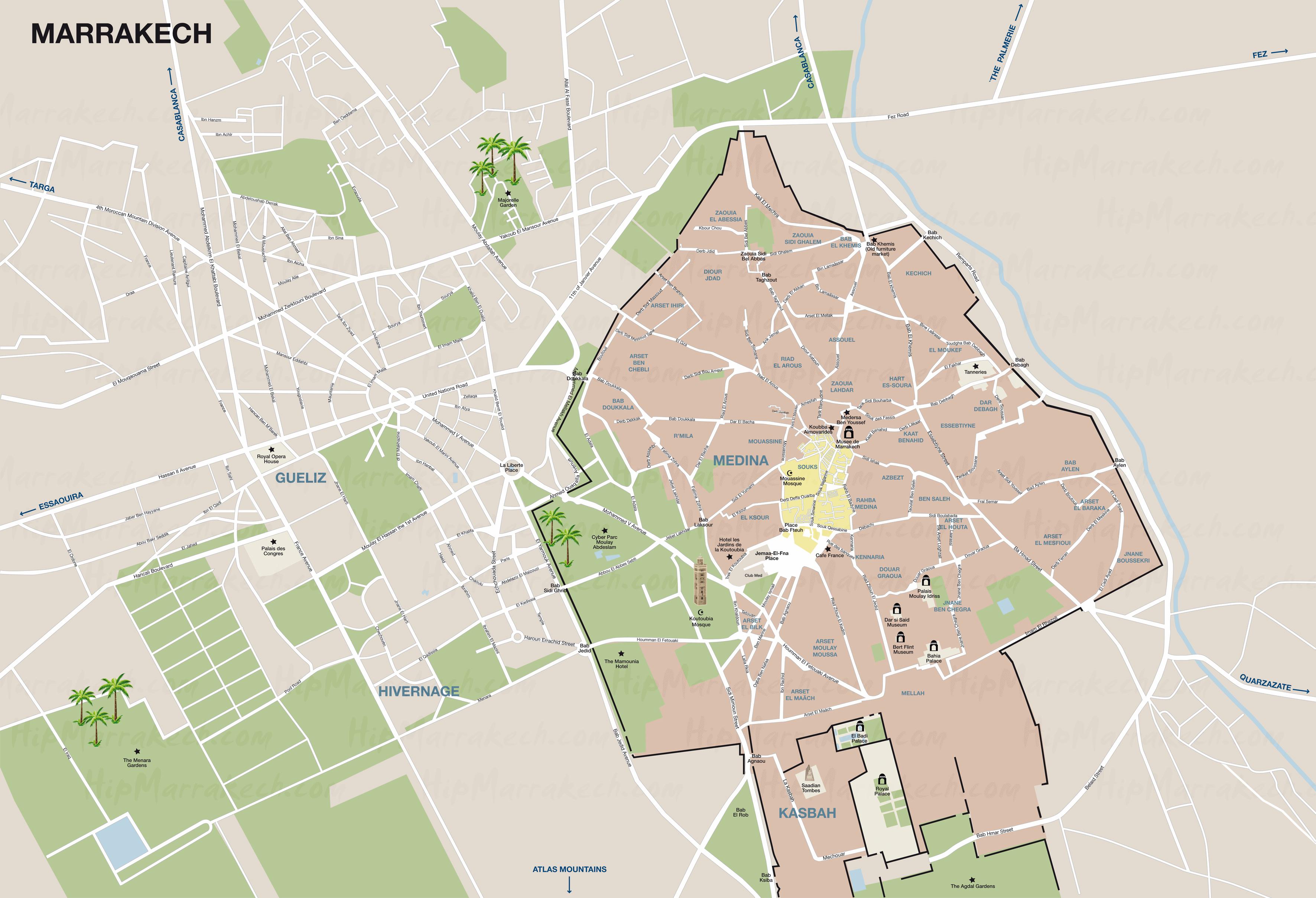
1/ TOURISTIC MAP OF MARRAKECH – 1400 x 1323 – 523 ko
TOURISTIC MAP OF MARRAKECH
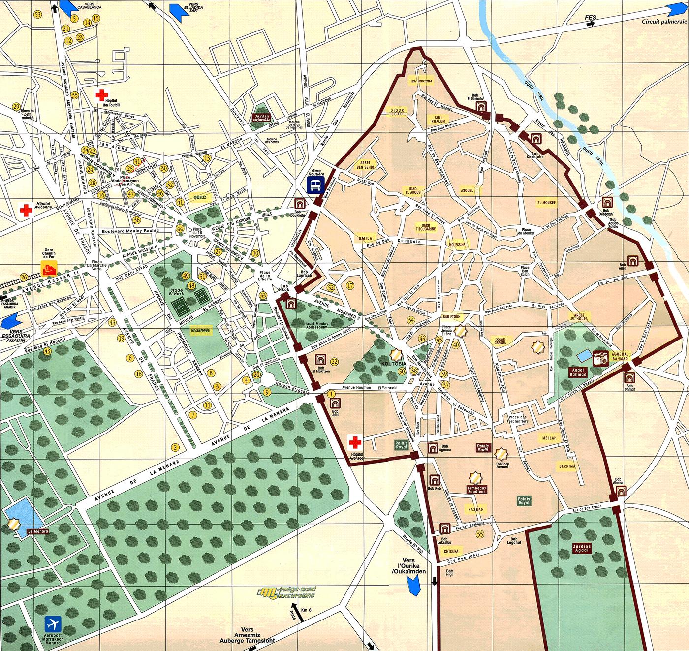
Maps of Marrakech
To Save, Print or Zoom the map, “Right Click” and “Save As”
Marrakech Maps : Medina and Guéliz, with Hospitals, Train Station and Bus Station as well as the city’s main Gardens and Gates along the Wall that surrounds the Medina, Menara Airport.
View Article How to Get around Marrakech by Public Transport
2/ TOURISTIC MAP HACHETTE OF MARRAKECH – 1100 x 842 – 228 ko
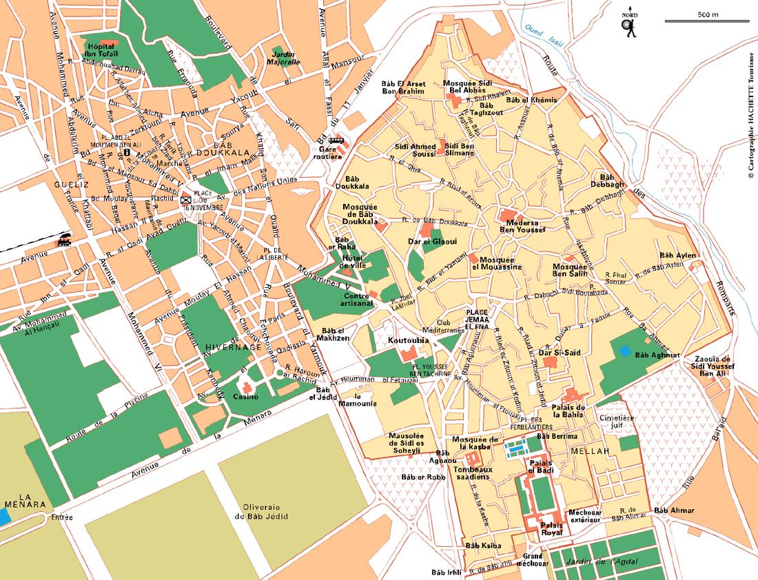
Maps of Marrakech
To Save, Print or Zoom the map, “Right Click” and “Save As”
Marrakech Maps: Medina and Guéliz, with the Museums, Tourist Office, Train Station and Bus Station as well as the main gardens of the city and the main Gates along the Wall that surrounds the Medina. Copyright Hachette
View Article Marrakech Useful Travel Advice
3/ ILLUSTRATED TOURIST MAP OF MARRAKECH – 1622 x 1207 – 389 ko
To Save, Print or Zoom the map, “Right Click” and “Save As”
Marrakech Maps: Medina and Guéliz, with the Museums, the Train Station and Bus Station as well as the main gardens of the city and the main Gates along the Wall that surrounds the Medina, the Circuit de la Palmeraie, the Oued (river) Issil, the Airport.
View Article What to See in the Medina of Marrakech ?
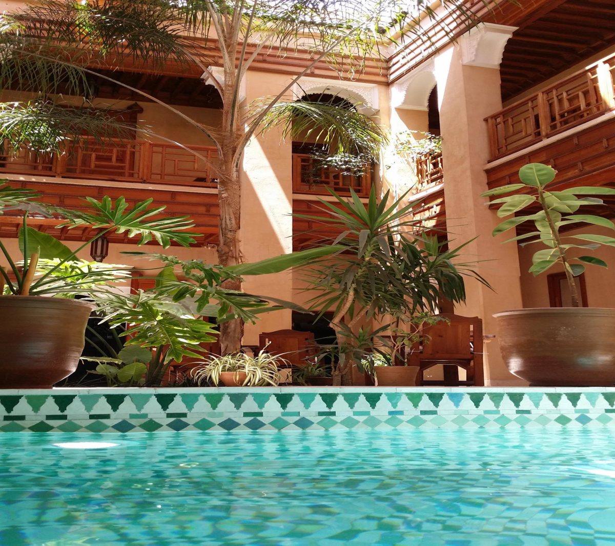
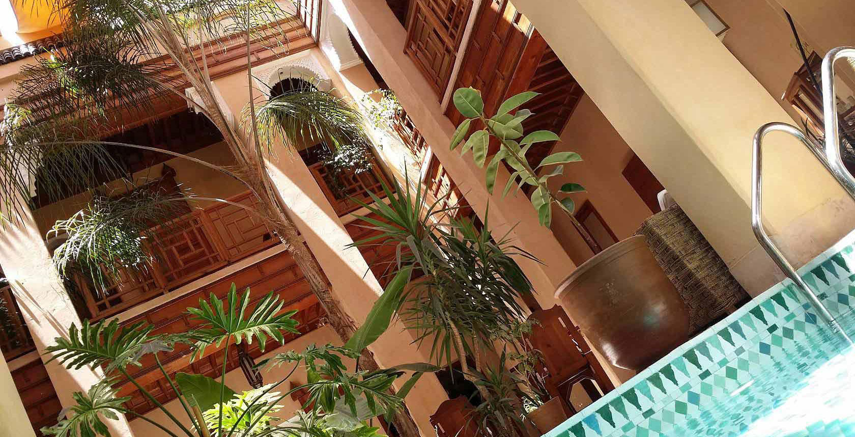
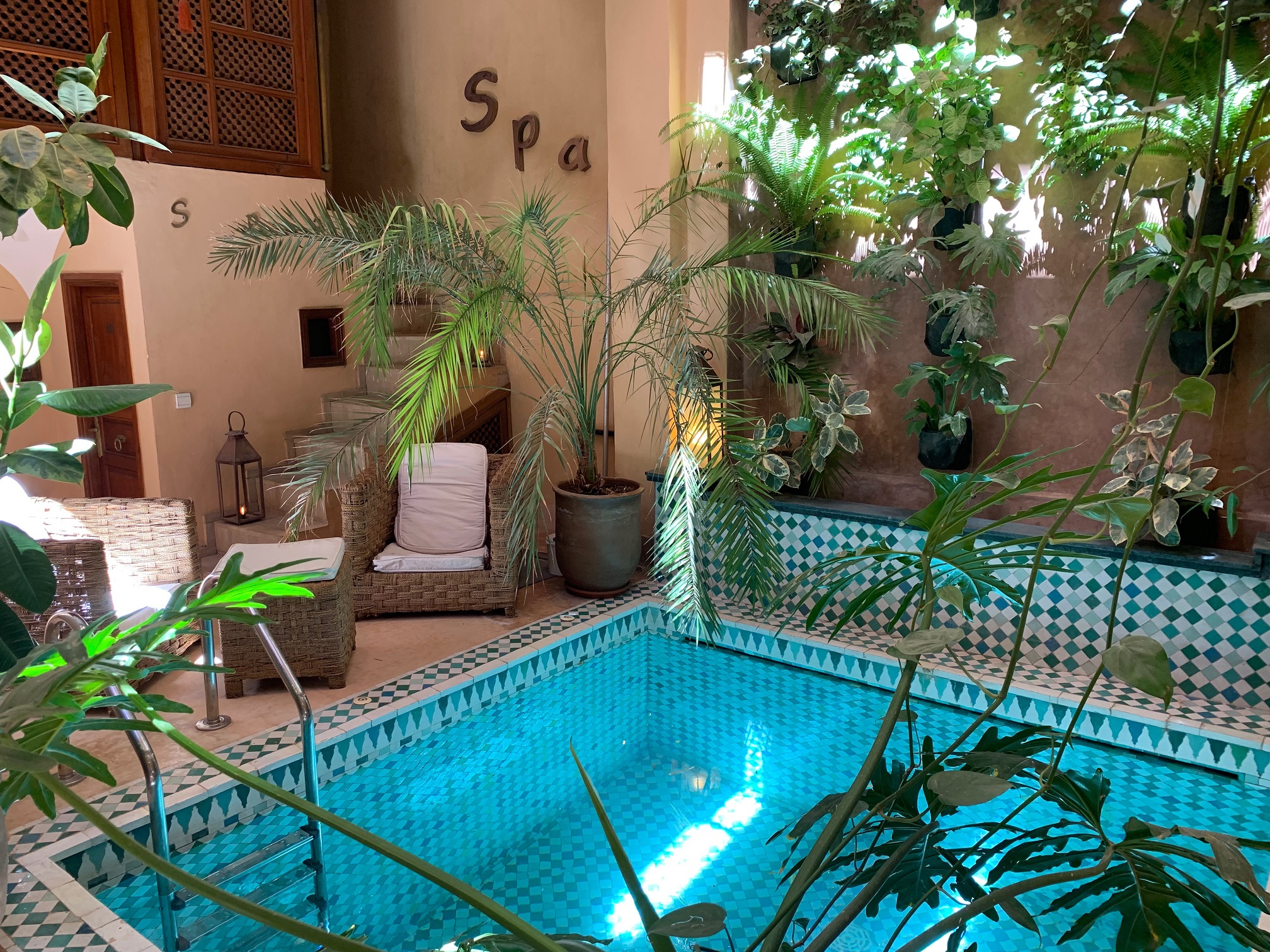
Riad Al Ksar Hotel of Charm Swimming pool Marrakech medina
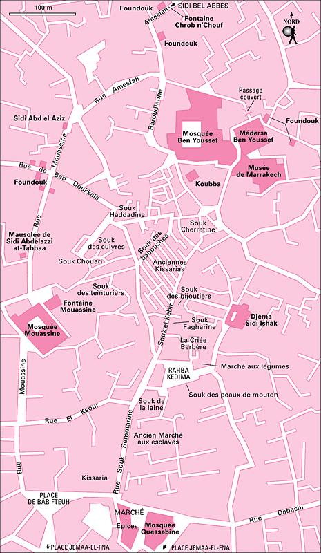
4/ SOUKS OF MARRAKECH MAP – 465 x 800 – 80 ko
To Save, Print or Zoom the map, “Right Click” and “Save As”
Map of Marrakech: Souks in Medina with the Ancient Slave Market, Bab Fteuh Square, Mouassine Fountain, Médersa Ben Youssef, Qoubba, Marrakech Museum, Foundouks (caravanserail), Chrob n Chouf Fountain, Rahba Kedima Square.
Read Article Weather & Temperatures by Month in Marrakech
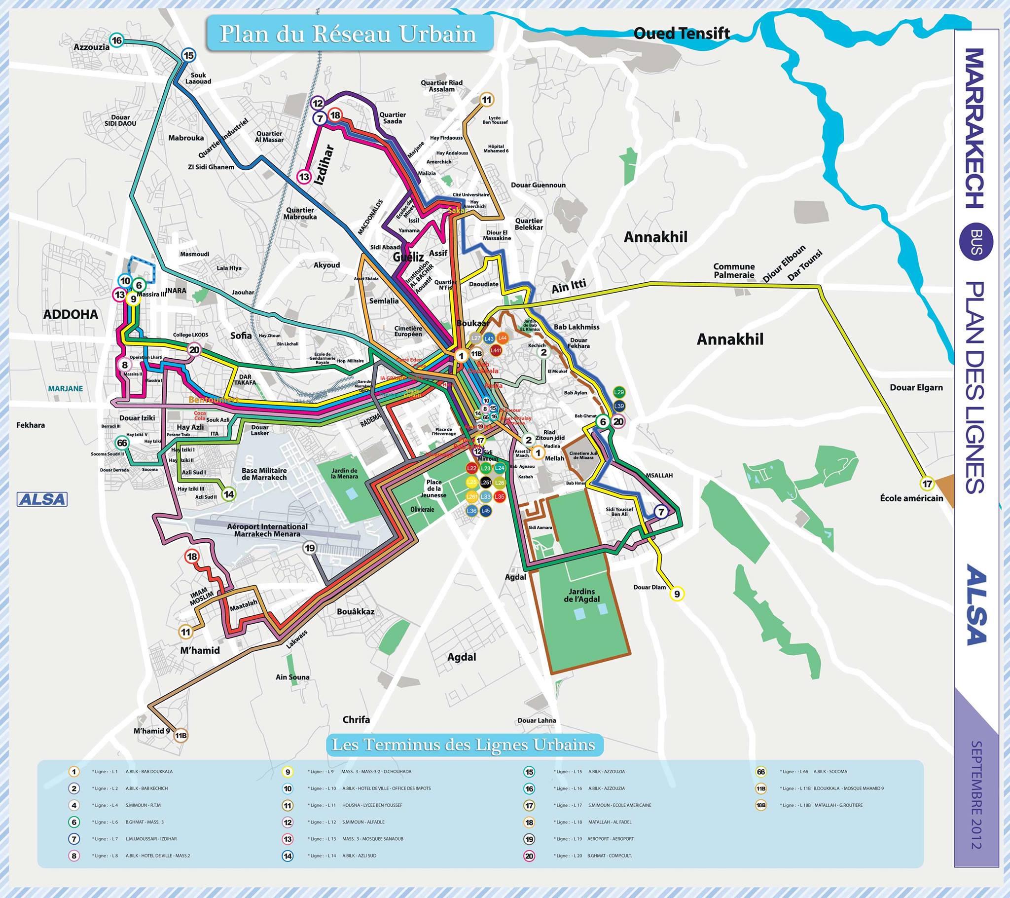
5/ ALSA BUS NETWORK IN MARRAKECH MAP – 2048 x 1820 – 441 ko
Bus Maps of Marrakech
To Save, Print or Zoom the map, “Right Click” and “Save As”
Maps of Marrakech: Urban Bus Network in Medina and Guéliz. Notably Bus 19 from the Airport to the city centre, Bus #1 between the Medina and Guéliz
Read Article Marrakech City Districts
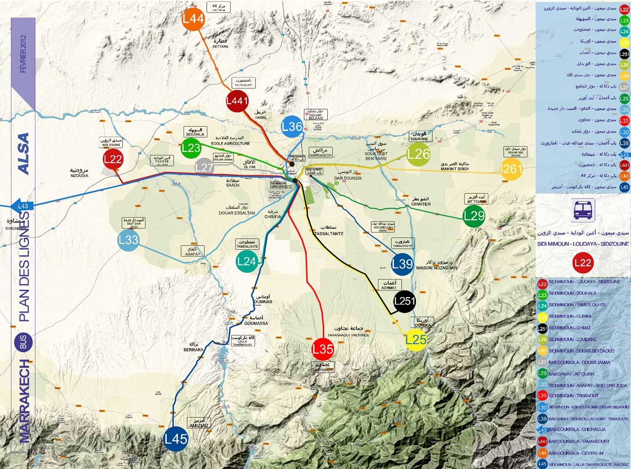
6/ REGIONAL BUS NETWORK MARRAKECH MAP – 1296 x 963 – 358 ko
To Save, Print or Zoom the map, “Right Click” and “Save As”
Maps Maps of Marrakech: Periurban Bus Network around Marrakech. Notably the Bus L45 which goes up to the Dam Lalla Takarskoute, or the Bus L25 which goes to the village of Ourika (Warning !! the Village of Ourika is NOT the village at the foot of the waterfalls of the ourika which is called Setti Fatma)
Visit Riad Al Ksar & Spa in the Medina of Marrakech
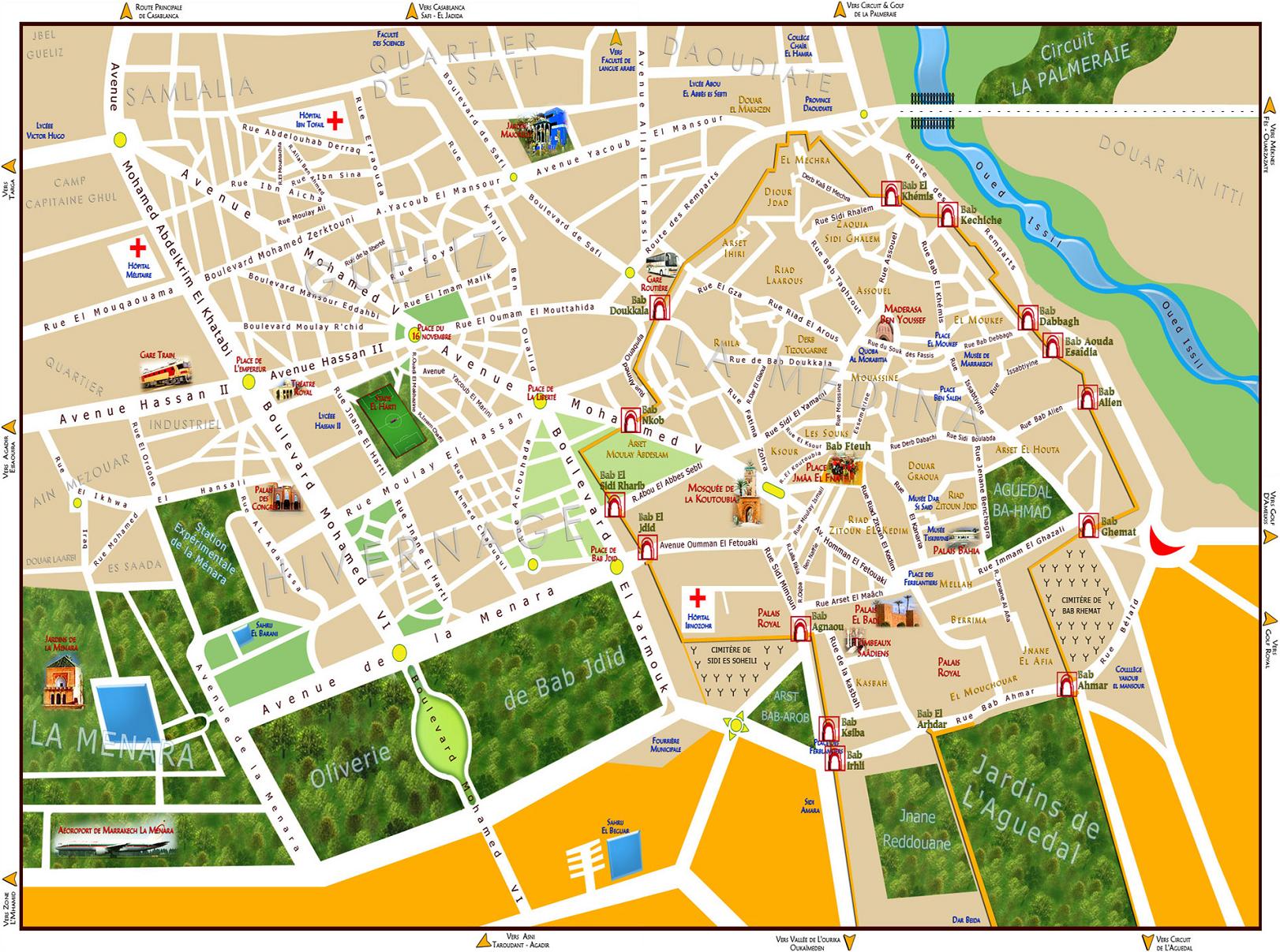
7/ MARRAKECH DISTRICTS MAP – 3543 x 2419 – 716 ko
To Save, Print or Zoom the map, “Right Click” and “Save As”
Map of Marrakech: Medina and Guéliz, with Museums and Monuments in Medina, the Palace of Congresses, the Royal Theatre, Tanneries, Parks and Gardens.
Don’t Miss a Traditionnal Hammam & Massage for Couples in Marrakech Medina
8/ RED BUS TOURIST BUS OF MARRAKECH – 2126 x 2002 – 854 ko
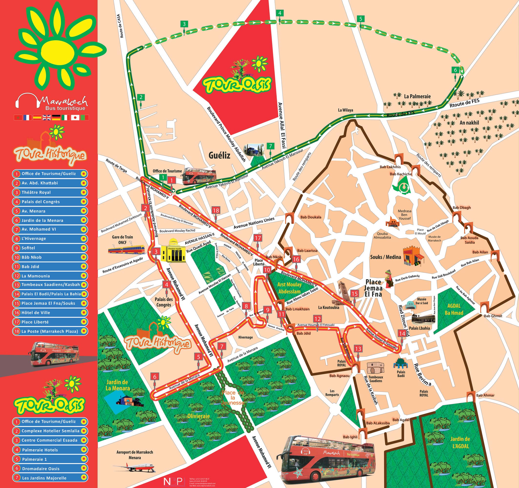
To Save, Print or Zoom the map, “Right Click” and “Save As”
Maps Maps of Marrakech: Tourist “Red Bus” Network. Tickets can be purchased directly on board the Bus. The rate is about 150dhs for 24h. There is also a rate for 48 hours. Headphones are also available on board to hear comments along the circuit. It is possible to drop on and off freely at any stop. There are 2 routes: 1 Monumental/Historical route for the Tourist Monuments in the City, and 1 Oasis route that leads you to the Majorelle Garden and the Palm grove. Bus frequency is about 20 to 30 minutes for the historic road and 1 hour for the Oasis road. Stop #14 is located 200 meters from Riad Al Ksar, on the Place des Ferblantiers or Place Ksadria, between Palais Bahia and Palais Badii.
Go Back to Marrakech Blog Homepage
Spa & Riad Marrakech Al Ksar
9/ MOROCCAN TRAIN NETWORK ONCF TRAINS MAP – 796 x 610 – 43 ko
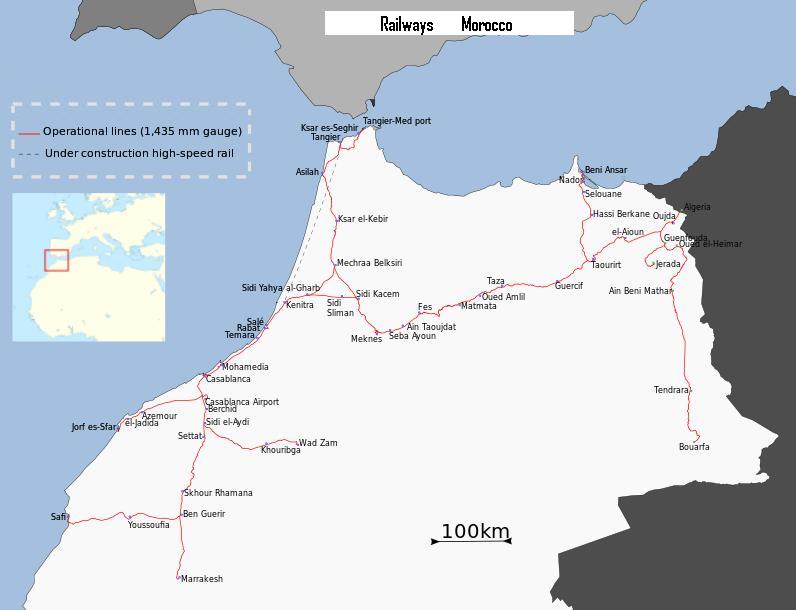
To Save, Print or Zoom the map, “Right Click” and “Save As”
Map of Marrakech: Trains Network in Morocco ONCF from Marrakech Station to Northern Morocco. Travelling by train is rather slow. The LGV High Speed Line between Tangier and Casablanca will remedy this slowness.
Discover the Activities to Do in Marrakech & Around
10/ MICHELIN ATLAS OURIKA OUARZAZATE SOUTH MOROCCO MAP – 1180 x 909 – 238 ko
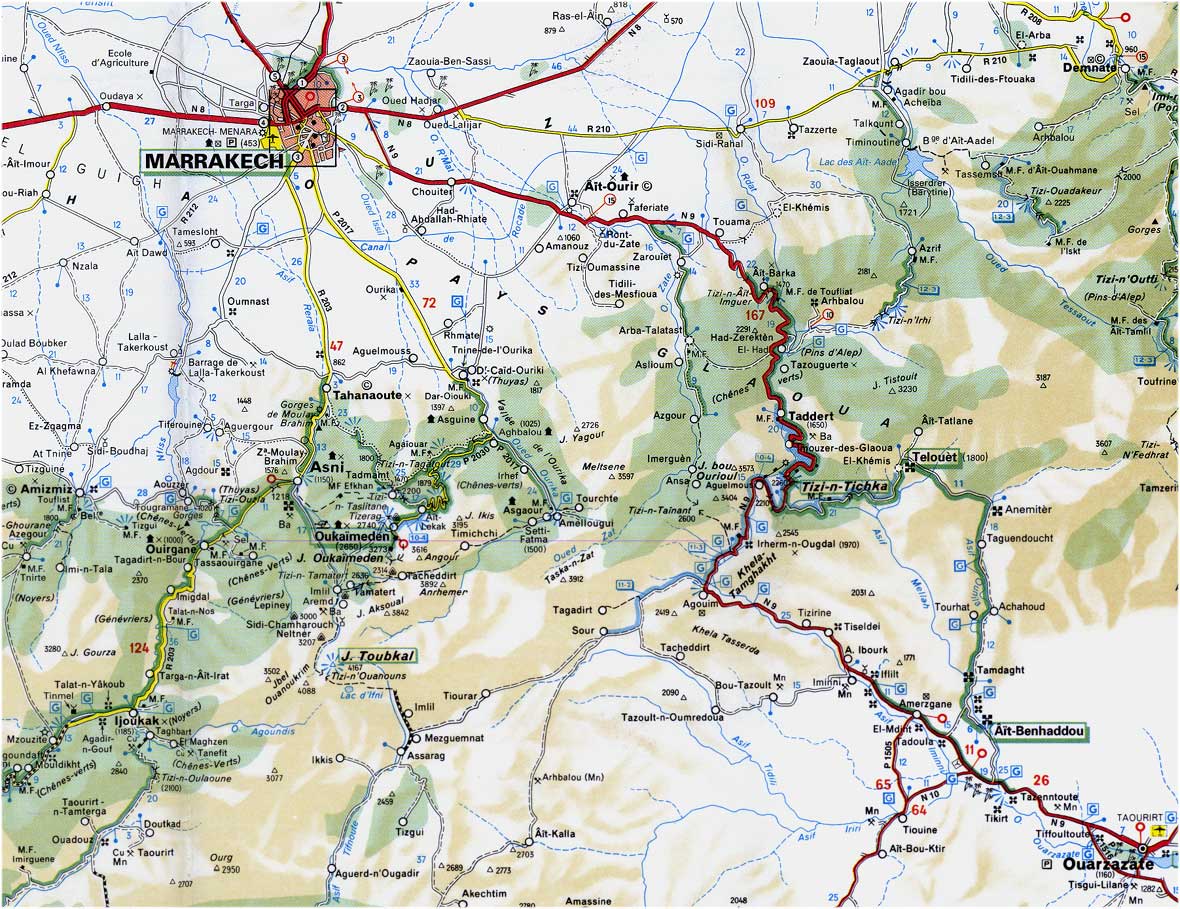
To Save, Print or Zoom the map, “Right Click” and “Save As”
Road Map of Southern Morocco, with, south, the Ourika Valley, Setti Fatma, Oukaimeden, Asni and Imlil, at the foot of Toubkal, in the High Atlas Region.
Also, towards the south east, Ouarzazate is accessible by the National Road #9 through the Tizi n Tichka pass and the site of Ait BenHaddou, 10 km before Ouarzazate. There is a variant to go to Ouarzazate, called the road of the Kasbahs, through Telouet and Anemiter, where Jacques Majorelle painted many paintings. It is also possible to go to Amizmiz, the Lalla Takerskoust dam.
National road #8 to the West leads to Essaouira
Discover the Excursions to Do around Marrakech for the Day
11/ HISTORIC MAP OF MARRAKECH 1935 – 2750 x 2306 – 1440 ko
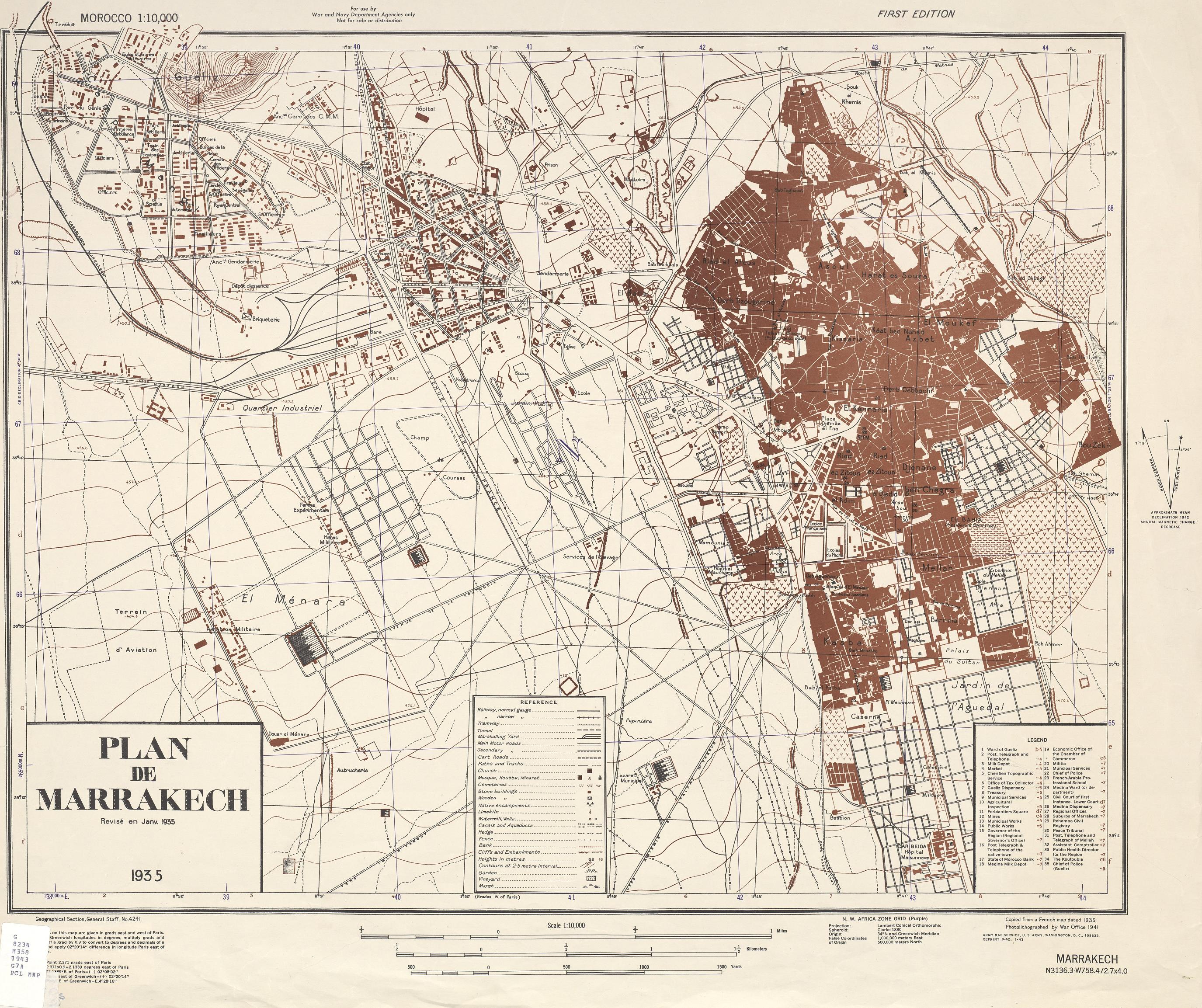
To Save, Print or Zoom the map, “Right Click” and “Save As”
Map of the French Protectorate era from the American War Department, from a copy of a 1935 French Map. One can see the Sultan’s Palace of the time, now the Royal Palace. Also the General Residence and the Garden of Bahia, in place of the current Palace of Bahia as well as the Palace of the Pasha Glaoui of the City in place of the current Dar El Bacha.
The Mamounia already existed as well as the church of Guéliz. In the Guéliz district, there is a race field, a military airfield and a military Harras
You might also be interested in:
Get Around Marrakech by Public Transport
©alksar 2019 – https://www.alksar.com